Landsat remote sensing of Florida
The data for this video was collected by Landsat 5 on November 10, 2011.
source: https://svs.gsfc.nasa.gov/cgi-bin/details.cgi?aid=11491
Remote sensing is collecting data about a target without actually touching the target. So In a very broad sense you are remote sensing when you see a bird in a tree and hear its song. You can use instruments to enhance your senses. Using this broad definition of remote sensing, there are many types of platforms upon which to deploy an instrument. Satellites and aircraft collect the majority of base map data and imagery used in Geographical Information Systems (GIS). The sensors typically deployed on these platforms include film and digital cameras, light-detection and ranging (lidar) systems, synthetic aperture radar (SAR) systems, multispectral and hyperspectral scanners. Many of these instruments can also be mounted on land-based platforms, such as vans, trucks, tractors, tanks and towers. In this presentation we will focus on Landsat satellites.
Landsat satellites have been transmitting data about the Earth continuously since 1972, over 4 decades, and Landsat 9 is planned for launch in 2023, maintaining that continuous stream of data. Landsat satellites circle the globe every 99 minutes, collecting data about the land surfaces passing underneath. After 16 days, the Landsat satellite has passed over every spot on the globe, and recorded data in 11 different wavelength regions. The individual wavelength bands can be combined into color images, with different combinations of the 11 bands revealing different information about the condition of the land cover.
Landsat 8 completes just over 14 orbits per day, covering the entire Earth between 81 degrees north and south latitude every 16 days.
Source: https://www.youtube.com/watch?v=P-lbujsVa2M
Although there are instruments that provide much higher resolution than Landsat none have the historical archive or the ease of access and economy (free) of Landsat.
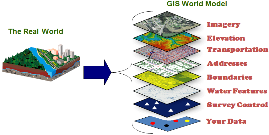
Geographic Information System Technology (GIS) is the hardware and software that allows the data to be processed, analyzed and displayed in ways that allow users to make decisions that need to be made based on data. Maps, tables and charts can be produced by GIS for various scenarios that help the user make and support their decisions.

source: https://henrico.us/gis/
GIS is used by many industries and government agencies in their decision making processes.

Questions:
1. What Landsat satellites are operating today?
2. How many days does it take for a Landsat satellite to go over the same area?
3. What wavelength bands would provide a false color image?
4. What percentage of users would be involved in agricultural studies?


