
 Recreational Activity Impacts
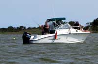
Boating—The effects of sea-level rise may impact where visitors can go boating. In some cases, new inlets may form that could provide increased recreational boat access to deeper waters in new and different areas. On the other hand, increased overwash of sand to the bay-side of the island may hinder boating by increasing sedimentation and shallow areas. Photo credit: NPS ASIS.Recreational Activity Impacts

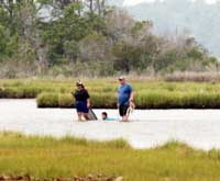
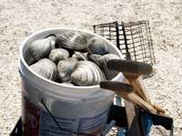
Shellfishing—Hard-shell clams rely on the bay subtidal and mud habitats and are very sensitive to salinity levels. With the effects of sea-level rise, clam populations could increase as inlets open and salinity levels increase. Clammers may benefit if there are more clams, but access areas to bay-side habitats may change as the island adapts to sea-level rise. Photo credit: Jane Hawkey, IAN/UMCES.Recreational Activity Impacts

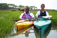
Kayaking—Kayakers are able to explore secluded coves of the salt marshes and view various wildlife. As sea level rises, the protected bay waters along the eastern side of the island may become more challenging to navigate due to inlet formation and overwash. Photo credit: NPS ASIS.Recreational Activity Impacts

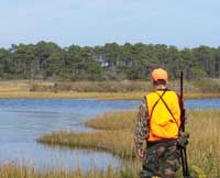
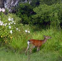
Hunting—The availability of freshwater is important for white-tailed deer and small sika elk. Saltwater intrusion into freshwater ponds from rising sea level could alter the distribution of some popular game species. Access routes to duck blinds and hunting areas is also likely to change as the island conditions change. Photo credit: NPS ASIS.Recreational Activity Impacts

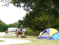
Camping—Sea-level rise and more frequent and intense storms could impact dune formation as the island rolls over and becomes increasingly dynamic. Existing campgrounds may have to be reconfigured or relocated to more stable parts of the island. Photo credit: Jane Hawkey, IAN/UMCES.Recreational Activity Impacts

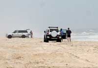
Over-sand Vehicle Use—As sea level rises and storm surge increases flooding on the island, driving over-sand vehicles along the beach may become more challenging due to higher tides and more frequent overwash events. Photo credit: Jane Hawkey, IAN/UMCES.Recreational Activity Impacts
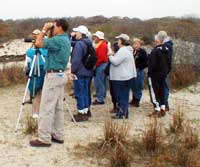
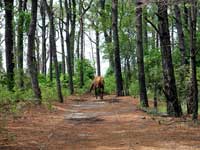
Wildlife Viewing—The population and distribution of some wildlife species may change as sea level rises and habitat conditions evolve. Some species may move away, while new species may appear. Certain species that rely on overwash habitats may be enhanced due to an increasingly dynamic landscape. Photo credit: NPS ASIS.Recreational Activity Impacts

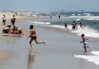
Beach Use—Park beach facilities such as bathhouses, boardwalks, and parking lots are located next to the beaches. As sea level rises and storm surge increases on the island, roads, facilities, and parking lots may become flooded more frequently. Beach access may change over time. Photo credit: Jane Hawkey, IAN/UMCES.Recreational Activity Impacts

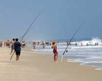
Fishing—With a permitted over-sand vehicle, surf fishermen are able to scout and fish large stretches of shoreline. As sea level rises and offshore habitats change, some fish species may move to different locations and new species may take their place. New inlets may provide additional access for boaters to reach deep water habitats. Photo credit: NPS ASIS.Recreational Activity Impacts

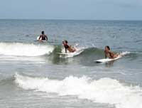
Surfing—The summer surf is often gentle enough for the beginner, but during storms which may become more frequent, it can challenge even an experienced surfer. Visiting surfers will be able to take advantage of larger waves as sea level rises and storm frequency increases. Photo credit: NPS ASIS.
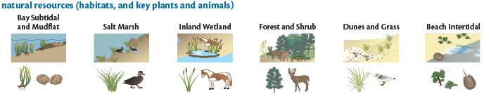
 Bay Subtidal and Mudflat Habitat
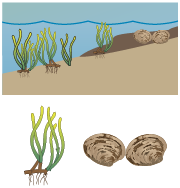
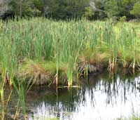
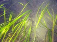
Seagrass—Seagrasses, the most common being eelgrass (Zostera marina), are found in the clear, shallow bay waters behind Assateague Island.
Clams—Hard-shell clams (Mercenaria mercenaria) burrow into the soft sand and mud within the bay subtidal areas.
Photo credit: NPS ASIS.
 Salt Marsh Habitat
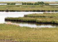
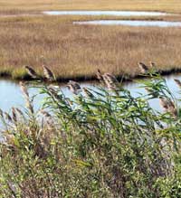
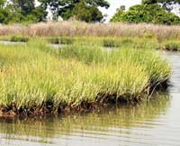
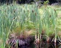
Cordgrass—Salt marsh cordgrass (Spartina alterniflora) grows throughout the marshes of Assateague Island and is a favorite food of the wild horses.
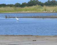
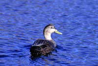
Waterfowl—The American black duck (Anas rubripes) is a dabbling duck that feeds and nests in the salt marshes.
Photo credit: Jane Hawkey, IAN/UMCES.
 Inland Wetland Habitat
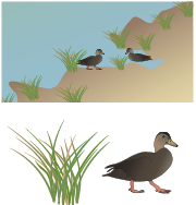
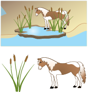
Cattails—Aquatic plants like cattails (Typha xglauca) grow in freshwater environments like those found within the interior wetlands on Assateague Island.
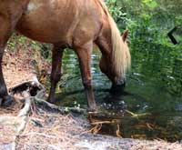
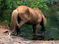
Wild horses—Assateague’s wild horses (Equus caballus) are perhaps the island’s best-known inhabitants. They roam the park, grazing and browsing low-lying vegetation, drink freshwater from the interior ponds, and seek out the ocean breezes to escape insects.
Photo credit: Jane Hawkey, IAN/UMCES.
 Forest and Shrub Habitat
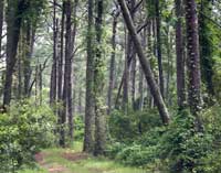
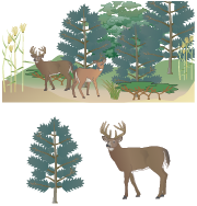
Pines—Tall loblolly pines (Pinus taeda) dominate the dense forests that occur on the widest portions of Assateague Island.
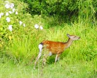
Deer—White-tailed deer (Odocoileus virginianus) and non-native Sika elk (Cervus nippon) thrive within the forest and shrub communities along Assateague Island.
Photo credit: NPS ASIS.
 Dunes and Grass Habitat
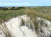
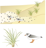
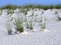
Beach grass—American beachgrass (Ammophila breviligulata) is the primary plant that dominates dune habitats.
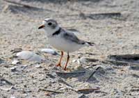
Shorebird—Piping plovers (Charadrius melodus) are migratory shorebirds that visit Assateague Island each spring and summer.
Photo credit: NPS ASIS.
 Beach Intertidal Habitat
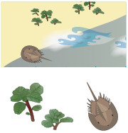
Seabeach amaranth—Seabeach amaranth (Amaranthus pumilus) is a very rare plant found on Assateague Island. They grow on the beach and dune areas that have been leveled and cleared of other plants by overwash.
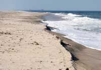
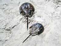
Horseshoe crabs—Horseshoe crabs (Limulus polyphemus) live primarily in shallow ocean waters on soft sandy bottoms and occasionally come on shore for mating. They are used for bait and biomedical use, and their eggs are a major source of food for migratory shorebirds.
Photo credit: Jane Hawkey, IAN/UMCES.
 Monitoring Activities on Assateague Island
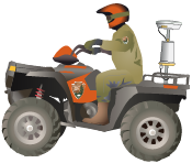
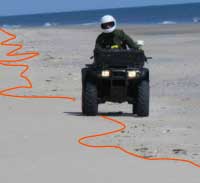
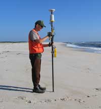
Beach Shoreline Rate of Change—A Global Positioning System (GPS) receiver is mounted on an All Terrain Vehicle (ATV) and driven along the high tide line on the beach. The shoreline recorded in each survey is compared to shoreline surveys from other years of the same season in order to estimate rate of change or effects of erosion by storms. Photo credit: Neil Winn, NPS ASIS.
 Monitoring Activities on Assateague Island
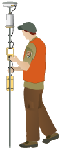
Beach Topography—Cross-island topographic profiles are recorded to measure elevation change over the entire barrier island. Elevation points are collected at regular intervals and at every significant change in topography (higher or lower areas) along a predetermined line, called a transect, crossing the island from the bay to the ocean. These points are plotted into graphs to illustrate the topographic profile that can be compared to other surveys to understand changes in the island's elevation over time. Photo credit: Neil Winn, NPS ASIS.
 Monitoring Activities on Assateague Island
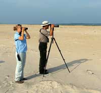
Piping Plover Nests and Fledgling Success—A biologist carefully searches the beaches, dunes, and grasslands during the breeding season with binoculars and spotting scopes to identify, count, and record the number and locations of piping plovers. All nests found are protected from predators with special fencing and monitored daily to determine hatching and fledging success. From this data, rates are calculated and compared to past years to identify population trends. Photo credit: NPS ASIS.
 Monitoring Activities on Assateague Island
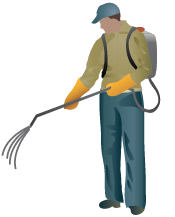
Phragmites Management—Phragmites (Phragmites australis) is not a native plant on the island. It has dramatically increased in abundance on Assateague Island during recent years, displacing native plant communities. Infestations of this plant are mapped with GPS and managed by cutting and spraying with an herbicide approved for use in wetland habitats. Treated areas have to be monitored closely for several years and typically require multiple re-treatments to achieve desired control. Photo credit: Jack Kumar, NPS ASIS.
 Monitoring Activities on Assateague Island
Deer Population—Native white-tailed deer (Odocoileus virginianus) and non-native sika elk (Cervus nippon) are currently being studied on Assateague Island to determine the impact their grazing has on park forest and shrub habitats. A series of fenced exclosures allow for comparison of areas where deer are kept out with those that are grazed by deer. Remote camera surveys are also used to identify population trends. Photo credit: NPS.
 Monitoring Activities on Assateague Island
Freshwater Pond Quality—During periods of rain, many freshwater ponds form in depressions in the interior of the island. Some are small and temporary, while other larger ponds fed by groundwater provide refreshment for wildlife well into the dry summer months. Some reptiles and amphibians are vulnerable to changes in the pH (a measure of acidity and alkalinity of a solution) of the water due to air pollution. Monitoring the pH will alert the park to related impacts on the water quality in the ponds. Photo credit: Jane Hawkey, IAN/UMCES.
 Monitoring Activities on Assateague Island
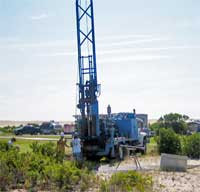
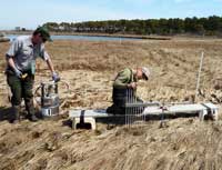
Groundwater Level—A rise in sea level will result in an upward and landward shift in the position of the mixing zone of freshwater and saltwater. To track changes in groundwater levels and position, monitoring wells have been established along the island. Automatic sensors are deployed within each well to establish long-term trends. If the depth of the mixing zone decreases, the likelihood of saltwater intrusion into the groundwater increases. Photo credit: John Masterson, USGS.
 Monitoring Activities on Assateague Island
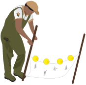
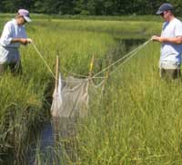
Salt Marsh Nekton Survey—The salt marshes of Assategue Island provide a critical link between land and water habitats. Nekton are the young fish and crabs found there that have unique responses to environmental change. The type and abundance of nekton may indicate changes such as sea-level rise, pollution, and new species. Stretching a net across a narrow section of the salt marsh, park technicians trap and record the nekton captured. Photo credit: NPS ASIS.
 Monitoring Activities on Assateague Island
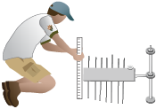
Surface Elevation Table—Understanding whether or not salt marshes can tolerate a higher sea level requires knowledge of whether the present–day marsh is able to maintain elevation. This information, when collected over time, provides an indication of whether the marsh is able to rebuild at a rate sufficient to keep up with increases in sea level. A technician uses a Surface Elevation Table (SET) device to monitor changes in the elevation of the marsh surface. Photo credit: Neil Winn, NPS ASIS.
 Monitoring Activities on Assateague Island
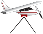
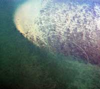
Seagrass Area—Annual aerial photo surveys are conducted from a small airplane to identify visible seagrass meadows in the bays. These images are compared to areas of known potential habitat to determine changes in seagrass abundance. Field sampling of seagrass species is also done to assess whether any shift from cool water to warm water species is underway. Photo credit: Neil Winn, NPS ASIS.
 Monitoring Activities on Assateague Island
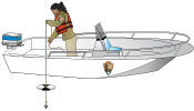
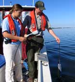
Bay Water Quality—Water quality in the bay is monitored by direct sampling by technicians in boats and by automated instruments that sit in the water and transmit data describing water clarity, nutrient levels, temperature, and salinity. Monitoring bay water allows the identification of changing conditions, which will help the park to protect habitat for bay plants and animals. Photo credit: Brian Sturgis, NPS ASIS.
 Monitoring Activities on Assateague Island
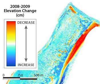
Upland Elevation Change—A small plane with Light Detection and Ranging (LiDAR) equipment aboard surveys the area. It uses lasers to bounce light off of the Earth’s surface, and records the time it takes for each beam to reflect back to the plane’s sensor. Since the speed of light is known, these time measurements are used to calculate the elevations of each reflection point. The differences between two different LiDAR surveys can be used to create maps illustrating changes in the island’s topography over time. Image credit: Neil Winn, NPS ASIS.
YOU FOUND IT!
Assateague Island is the only piping plover nesting site in Maryland and one of the densest breeding areas on the eastern seaboard. The loss of breeding habitat elsewhere in the region means that the protected beaches of Assateague are vital to the species continued survival.
Recreational Activities on Assateague IslandBoating—The bays behind Assateague Island provide a large area for recreational boating. Photo credit: NPS ASIS.Recreational Activities on Assateague Island
Shellfishing—Clamming is a popular activity for many visitors to the bay subtidal and mud habitats on Assateague Island. Wading through the shallow water, clammers use a rake or their toes to feel for clams buried in the mud. Photo credit: Jane Hawkey, IAN/UMCES.Recreational Activities on Assateague Island
Kayaking—Kayaking, fun for all ages, is often enjoyed in the salt marshes behind Assateague Island. Kayakers are able to explore secluded coves and view various wildlife. Photo credit: NPS ASIS.Recreational Activities on Assateague Island
Hunting—Hunting of white-tailed deer and sika deer (actually, a very small elk) is allowed in specified areas on Assateague Island. Duck hunting in the marshes is also allowed during certain seasons. Photo credit: NPS ASIS.Recreational Activities on Assateague Island
Camping—Assateague Island is a fun place to camp overnight, enhancing exploration of the barrier island features and wildlife. Visitors may have to share their campsite with a wild horse or two. Photo credit: Jane Hawkey, IAN/UMCES.Recreational Activities on Assateague Island
Over-sand Vehicle Use—Driving permitted vehicles on specified areas of the beach at Assateague Island allows visitors to surf fish the ocean and travel off-road farther down the shore. Photo credit: Jane Hawkey, IAN/UMCES.Recreational Activities on Assateague Island
Wildlife Viewing—Visitors come to view Assateague Island’s many unique and a few rare plants and animals. They enjoy seeing the migratory birds that visit the island during spring and fall, and look for turtles and frogs in the interior wetlands. Photo credit: NPS ASIS.Recreational Activities on Assateague Island
Beach Use—The most common and very popular activity for visitors on Assateague Island National Seashore is to spend the day at the beach. Photo credit: Jane Hawkey, IAN/UMCES.Recreational Activities on Assateague Island
Fishing—Surf fishing, the sport of catching fish standing on the beach or wading in the ocean surf, on Assateague Island is a popular activity. Photo credit: NPS ASIS.Recreational Activities on Assateague Island
Surfing—Assateague Island offers great surfing opportunities. The summer months bring gentle waves, perfect for beginners. Photo credit: NPS ASIS.
 Impacts to Plants and Animals
Seagrass—Seagrasses provide food and habitat for numerous species of migratory birds, fish, clams and crabs. Light availability and water clarity limit the extent to which seagrass can grow. As sea level rises, shallow water habitats suitable for seagrasses may change. Eelgrass may be replaced by different aquatic plant species. Photo credit: Tim Carruthers, IAN/UMCES.
 Impacts to Plants and Animals
Clams—Hard clam populations in the bays behind Assateague Island increased dramatically after the Ocean City inlet was created in 1933, as a result of increased bay salinities. More frequent storms combined with sea-level rise may accelerate new inlet formation along the entire barrier island, increasing potential habitat for clams in the future. Photo credit: Jane Hawkey, IAN/UMCES.
 Impacts to Plants and Animals
Cordgrass—In higher areas, cordgrass provides important nesting habitat for marsh birds. Their roots stabilize the salt marsh and help to prevent shoreline erosion. Island overwash due to storm surge and sea-level rise will deposit more sand and sediment into these bayside habitats. Newly deposited sediments will form the base for an expanded salt marsh plant community. Photo credit: Jane Hawkey, IAN/UMCES.
 Impacts to Plants and Animals
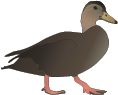
Waterfowl—American black ducks eat seagrasses and small mollusks on the bottom by ‘tipping up’ their tails to submerge their head and reach their food. As salt marshes are inundated by sea-level rise, food and secluded nesting habitat will be hard to find. Photo credit: Gene Nieminen, US F&W.
 Impacts to Plants and Animals
Cattails—Stands of cattails grow vigorously and provide thick cover and protection for many wildlife species. Fresh groundwater turned saline by saltwater intrusion or increased storm overwash into inland freshwater habitats may change the plant species and communities that currently occupy these wetlands. Photo credit: Jane Hawkey, IAN/UMCES.
 Impacts to Plants and Animals
Wild horses—The wild horses of Assateague Island depend on freshwater ponds for drinking water. With the combined effects of storm surge and sea-level rise, saltwater intrusion is more likely to contaminate these freshwater sources. Over time, these ponds may become less suitable and eventually undrinkable for the wild horses and other wildlife that depend on them. Some may be able to adapt over time if the water doesn't get too salty, while others will have to move to locations with freshwater sources. Photo credit: Jane Hawkey, IAN/UMCES.
 Impacts to Plants and Animals
Pines—Pine forests provide a refuge for deer, horses, and other wildlife species. Some of the island’s oldest trees can be found within these stable, mature pine forests. As sea level rises, storms intensify, and overwash increases, these forest trees will be threatened by saltwater intrusion, high winds, and changing conditions. Photo credit: Jane Hawkey, IAN/UMCES.
 Impacts to Plants and Animals
Deer—Valued by hunters, the deer and elk species found on the island depend on plants for food and cover. Fresh drinking water is also a necessity. As sea level rises, the freshwater available in the inland wetlands and ponds may become contaminated over time with increased saltwater intrusion and overwash. Photo credit: NPS ASIS.
 Impacts to Plants and Animals
Beach grass—Beach grass helps build dunes by trapping sand. As sand accumulates, the plant continues to grow by extending its roots deep into the ground to provide dune stability. As storm overwash increasingly erodes dunes due to sea-level rise, grasses will remain important sand stabilizers. Photo credit: Jane Hawkey, IAN/UMCES.
 Impacts to Plants and Animals
Shorebirds—Piping plovers rely on regular overwash processes to create and maintain sparsely vegetated sand flats that are used for nesting and foraging. As sea level rises and overwash becomes more frequent, piping plover habitat and productivity is expected to increase. Photo credit: Jane Hawkey, IAN/UMCES.
 Impacts to Plants and Animals
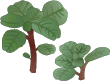
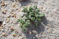
Seabeach amaranth—The sparsely vegetated upper beaches are home to the seabeach amaranth. Although sea-level rise may create more suitable beach habitat for this unique plant in the short term, increased overwash and drought may limit its overall success. Photo credit: Alex Fries, IAN/UMCES.
 Impacts to Plants and Animals
Horseshoe crabs—Horseshoe crabs have endured the changing oceanic environment for 350 million years, so it is unlikely that sea-level rise will pose a challenge for them. Photo credit: Jane Hawkey, IAN/UMCES.Yes, you found it!
This device is a water level monitor that is collecting data for a marsh restoration program being conducted at Assateague Island National Seashore.
YOU FOUND IT!
Piping plovers are attracted to the island's isolated, storm washed beaches which provide ideal areas for the threatened bird to nest and feed. The challenge for the National Park Service is to protect the plovers and other natural plant and animal species, while providing high quality recreational opportunities for the park’s many summer visitors.
YOU ARE GETTING WARMER!
ALMOST, BUT NOT QUITE RIGHT!
SORRY, YOU ARE NOT EVEN CLOSE!
| GET STARTED | Learn » |
Have you ever been to the beach?
Then, if you live on the Atlantic coast or Gulf of Mexico coast of the US, there is a chance that you have visited a barrier island.


Barrier islands are islands made of sand or sediment that lay parallel to much of the Atlantic mainland coastline from Maine to Mexico, and the Gulf of Mexico mainland coastline from Florida to Texas. They are also found worldwide with a total of 2,149 barrier islands globally.
For natural resources, barrier islands are valuable because they provide unique coastal habitats for plants and animals. They also help block storms from causing damage to mainland communities and properties, and provide recreation for people to swim, fish, hike, and camp.
Some barrier islands have large developments on them with hotels, shopping malls, vacation homes, amusement parks, and much more. Others have been left undeveloped as national or state parks where the natural resources are managed and protected.
One of the last Atlantic barrier islands that is undeveloped—Assateague Island
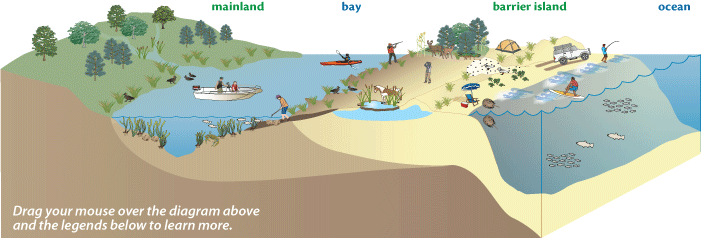
 along the coasts of Maryland and Virginia, bordered by the Atlantic Ocean to the east and the Sinepuxent and Chincoteague Bays to the west.")
Bill Hulslander, National Park Service (NPS) Chief of Resource Management at Assateague Island National Seashore, introduces us to this barrier island. The NPS manages and protects the natural resources of this park, while providing a wide range of recreational and educational choices for visitors.
Nature shapes Assateague Island
Assateague Island is a barrier island off the coast of Maryland and Virginia on the Atlantic Ocean. Built by sand that persistent waves have raised from the ocean's floor, the island is reshaped and moved by ocean waves and wind. Constantly rearranged by these natural forces of change, Assateague Island is one of the world's most dynamic places.

Treasures at the ocean's edge
Despite its relatively small size, less than 7284 ha (18,000 acres), a surprising array of habitats and natural features can be found on Assateague Island.
Explore the natural resources and human activities on Assateague Island by clicking on the diagram and legend below.
Experience the module at its best
We recommend that you explore the module by going through page by page in sequence. You will get a sense of its structure and dynamic features. To get the maximum quality on the videos, click on the HD icon before you view them. We hope you will find the Barrier Islands and Sea-level Rise module a fun and interesting learning experience.
Recreational Activity ImpactsBoating—The effects of sea-level rise may impact where visitors can go boating. In some cases, new inlets may form that could provide increased recreational boat access to deeper waters in new and different areas. On the other hand, increased overwash of sand to the bay-side of the island may hinder boating by increasing sedimentation and shallow areas. Photo credit: NPS ASIS.Recreational Activity Impacts
Shellfishing—Hard-shell clams rely on the bay subtidal and mud habitats and are very sensitive to salinity levels. With the effects of sea-level rise, clam populations could increase as inlets open and salinity levels increase. Clammers may benefit if there are more clams, but access areas to bay-side habitats may change as the island adapts to sea-level rise. Photo credit: Jane Hawkey, IAN/UMCES.Recreational Activity Impacts
Kayaking—Kayakers are able to explore secluded coves of the salt marshes and view various wildlife. As sea level rises, the protected bay waters along the eastern side of the island may become more challenging to navigate due to inlet formation and overwash. Photo credit: NPS ASIS.Recreational Activity Impacts
Hunting—The availability of freshwater is important for white-tailed deer and small sika elk. Saltwater intrusion into freshwater ponds from rising sea level could alter the distribution of some popular game species. Access routes to duck blinds and hunting areas is also likely to change as the island conditions change. Photo credit: NPS ASIS.Recreational Activity Impacts
Camping—Sea-level rise and more frequent and intense storms could impact dune formation as the island rolls over and becomes increasingly dynamic. Existing campgrounds may have to be reconfigured or relocated to more stable parts of the island. Photo credit: Jane Hawkey, IAN/UMCES.Recreational Activity Impacts
Over-sand Vehicle Use—As sea level rises and storm surge increases flooding on the island, driving over-sand vehicles along the beach may become more challenging due to higher tides and more frequent overwash events. Photo credit: Jane Hawkey, IAN/UMCES.Recreational Activity Impacts
Wildlife Viewing—The population and distribution of some wildlife species may change as sea level rises and habitat conditions evolve. Some species may move away, while new species may appear. Certain species that rely on overwash habitats may be enhanced due to an increasingly dynamic landscape. Photo credit: NPS ASIS.Recreational Activity Impacts
Beach Use—Park beach facilities such as bathhouses, boardwalks, and parking lots are located next to the beaches. As sea level rises and storm surge increases on the island, roads, facilities, and parking lots may become flooded more frequently. Beach access may change over time. Photo credit: Jane Hawkey, IAN/UMCES.Recreational Activity Impacts
Fishing—With a permitted over-sand vehicle, surf fishermen are able to scout and fish large stretches of shoreline. As sea level rises and offshore habitats change, some fish species may move to different locations and new species may take their place. New inlets may provide additional access for boaters to reach deep water habitats. Photo credit: NPS ASIS.Recreational Activity Impacts
Surfing—The summer surf is often gentle enough for the beginner, but during storms which may become more frequent, it can challenge even an experienced surfer. Visiting surfers will be able to take advantage of larger waves as sea level rises and storm frequency increases. Photo credit: NPS ASIS.
Bay Subtidal and Mudflat HabitatSeagrass—Seagrasses, the most common being eelgrass (Zostera marina), are found in the clear, shallow bay waters behind Assateague Island.
Clams—Hard-shell clams (Mercenaria mercenaria) burrow into the soft sand and mud within the bay subtidal areas.
Photo credit: NPS ASIS.
Salt Marsh HabitatCordgrass—Salt marsh cordgrass (Spartina alterniflora) grows throughout the marshes of Assateague Island and is a favorite food of the wild horses.
Waterfowl—The American black duck (Anas rubripes) is a dabbling duck that feeds and nests in the salt marshes.
Photo credit: Jane Hawkey, IAN/UMCES.
Inland Wetland HabitatCattails—Aquatic plants like cattails (Typha xglauca) grow in freshwater environments like those found within the interior wetlands on Assateague Island.
Wild horses—Assateague’s wild horses (Equus caballus) are perhaps the island’s best-known inhabitants. They roam the park, grazing and browsing low-lying vegetation, drink freshwater from the interior ponds, and seek out the ocean breezes to escape insects.
Photo credit: Jane Hawkey, IAN/UMCES.
Forest and Shrub HabitatPines—Tall loblolly pines (Pinus taeda) dominate the dense forests that occur on the widest portions of Assateague Island.
Deer—White-tailed deer (Odocoileus virginianus) and non-native Sika elk (Cervus nippon) thrive within the forest and shrub communities along Assateague Island.
Photo credit: NPS ASIS.
Dunes and Grass HabitatBeach grass—American beachgrass (Ammophila breviligulata) is the primary plant that dominates dune habitats.
Shorebird—Piping plovers (Charadrius melodus) are migratory shorebirds that visit Assateague Island each spring and summer.
Photo credit: NPS ASIS.
Beach Intertidal HabitatSeabeach amaranth—Seabeach amaranth (Amaranthus pumilus) is a very rare plant found on Assateague Island. They grow on the beach and dune areas that have been leveled and cleared of other plants by overwash.
Horseshoe crabs—Horseshoe crabs (Limulus polyphemus) live primarily in shallow ocean waters on soft sandy bottoms and occasionally come on shore for mating. They are used for bait and biomedical use, and their eggs are a major source of food for migratory shorebirds.
Photo credit: Jane Hawkey, IAN/UMCES.
Monitoring Activities on Assateague Island Beach Shoreline Rate of Change—A Global Positioning System (GPS) receiver is mounted on an All Terrain Vehicle (ATV) and driven along the high tide line on the beach. The shoreline recorded in each survey is compared to shoreline surveys from other years of the same season in order to estimate rate of change or effects of erosion by storms. Photo credit: Neil Winn, NPS ASIS.
Monitoring Activities on Assateague Island Beach Topography—Cross-island topographic profiles are recorded to measure elevation change over the entire barrier island. Elevation points are collected at regular intervals and at every significant change in topography (higher or lower areas) along a predetermined line, called a transect, crossing the island from the bay to the ocean. These points are plotted into graphs to illustrate the topographic profile that can be compared to other surveys to understand changes in the island's elevation over time. Photo credit: Neil Winn, NPS ASIS.
Monitoring Activities on Assateague Island Piping Plover Nests and Fledgling Success—A biologist carefully searches the beaches, dunes, and grasslands during the breeding season with binoculars and spotting scopes to identify, count, and record the number and locations of piping plovers. All nests found are protected from predators with special fencing and monitored daily to determine hatching and fledging success. From this data, rates are calculated and compared to past years to identify population trends. Photo credit: NPS ASIS.
Monitoring Activities on Assateague Island Phragmites Management—Phragmites (Phragmites australis) is not a native plant on the island. It has dramatically increased in abundance on Assateague Island during recent years, displacing native plant communities. Infestations of this plant are mapped with GPS and managed by cutting and spraying with an herbicide approved for use in wetland habitats. Treated areas have to be monitored closely for several years and typically require multiple re-treatments to achieve desired control. Photo credit: Jack Kumar, NPS ASIS.
Monitoring Activities on Assateague Island Deer Population—Native white-tailed deer (Odocoileus virginianus) and non-native sika elk (Cervus nippon) are currently being studied on Assateague Island to determine the impact their grazing has on park forest and shrub habitats. A series of fenced exclosures allow for comparison of areas where deer are kept out with those that are grazed by deer. Remote camera surveys are also used to identify population trends. Photo credit: NPS.
Monitoring Activities on Assateague Island Freshwater Pond Quality—During periods of rain, many freshwater ponds form in depressions in the interior of the island. Some are small and temporary, while other larger ponds fed by groundwater provide refreshment for wildlife well into the dry summer months. Some reptiles and amphibians are vulnerable to changes in the pH (a measure of acidity and alkalinity of a solution) of the water due to air pollution. Monitoring the pH will alert the park to related impacts on the water quality in the ponds. Photo credit: Jane Hawkey, IAN/UMCES.
Monitoring Activities on Assateague Island Groundwater Level—A rise in sea level will result in an upward and landward shift in the position of the mixing zone of freshwater and saltwater. To track changes in groundwater levels and position, monitoring wells have been established along the island. Automatic sensors are deployed within each well to establish long-term trends. If the depth of the mixing zone decreases, the likelihood of saltwater intrusion into the groundwater increases. Photo credit: John Masterson, USGS.
Monitoring Activities on Assateague Island Salt Marsh Nekton Survey—The salt marshes of Assategue Island provide a critical link between land and water habitats. Nekton are the young fish and crabs found there that have unique responses to environmental change. The type and abundance of nekton may indicate changes such as sea-level rise, pollution, and new species. Stretching a net across a narrow section of the salt marsh, park technicians trap and record the nekton captured. Photo credit: NPS ASIS.
Monitoring Activities on Assateague Island Surface Elevation Table—Understanding whether or not salt marshes can tolerate a higher sea level requires knowledge of whether the present–day marsh is able to maintain elevation. This information, when collected over time, provides an indication of whether the marsh is able to rebuild at a rate sufficient to keep up with increases in sea level. A technician uses a Surface Elevation Table (SET) device to monitor changes in the elevation of the marsh surface. Photo credit: Neil Winn, NPS ASIS.
Monitoring Activities on Assateague Island Seagrass Area—Annual aerial photo surveys are conducted from a small airplane to identify visible seagrass meadows in the bays. These images are compared to areas of known potential habitat to determine changes in seagrass abundance. Field sampling of seagrass species is also done to assess whether any shift from cool water to warm water species is underway. Photo credit: Neil Winn, NPS ASIS.
Monitoring Activities on Assateague Island Bay Water Quality—Water quality in the bay is monitored by direct sampling by technicians in boats and by automated instruments that sit in the water and transmit data describing water clarity, nutrient levels, temperature, and salinity. Monitoring bay water allows the identification of changing conditions, which will help the park to protect habitat for bay plants and animals. Photo credit: Brian Sturgis, NPS ASIS.
Monitoring Activities on Assateague Island Upland Elevation Change—A small plane with Light Detection and Ranging (LiDAR) equipment aboard surveys the area. It uses lasers to bounce light off of the Earth’s surface, and records the time it takes for each beam to reflect back to the plane’s sensor. Since the speed of light is known, these time measurements are used to calculate the elevations of each reflection point. The differences between two different LiDAR surveys can be used to create maps illustrating changes in the island’s topography over time. Image credit: Neil Winn, NPS ASIS.
YOU FOUND IT!
Assateague Island is the only piping plover nesting site in Maryland and one of the densest breeding areas on the eastern seaboard. The loss of breeding habitat elsewhere in the region means that the protected beaches of Assateague are vital to the species continued survival.
Recreational Activities on Assateague IslandBoating—The bays behind Assateague Island provide a large area for recreational boating. Photo credit: NPS ASIS.Recreational Activities on Assateague Island
Shellfishing—Clamming is a popular activity for many visitors to the bay subtidal and mud habitats on Assateague Island. Wading through the shallow water, clammers use a rake or their toes to feel for clams buried in the mud. Photo credit: Jane Hawkey, IAN/UMCES.Recreational Activities on Assateague Island
Kayaking—Kayaking, fun for all ages, is often enjoyed in the salt marshes behind Assateague Island. Kayakers are able to explore secluded coves and view various wildlife. Photo credit: NPS ASIS.Recreational Activities on Assateague Island
Hunting—Hunting of white-tailed deer and sika deer (actually, a very small elk) is allowed in specified areas on Assateague Island. Duck hunting in the marshes is also allowed during certain seasons. Photo credit: NPS ASIS.Recreational Activities on Assateague Island
Camping—Assateague Island is a fun place to camp overnight, enhancing exploration of the barrier island features and wildlife. Visitors may have to share their campsite with a wild horse or two. Photo credit: Jane Hawkey, IAN/UMCES.Recreational Activities on Assateague Island
Over-sand Vehicle Use—Driving permitted vehicles on specified areas of the beach at Assateague Island allows visitors to surf fish the ocean and travel off-road farther down the shore. Photo credit: Jane Hawkey, IAN/UMCES.Recreational Activities on Assateague Island
Wildlife Viewing—Visitors come to view Assateague Island’s many unique and a few rare plants and animals. They enjoy seeing the migratory birds that visit the island during spring and fall, and look for turtles and frogs in the interior wetlands. Photo credit: NPS ASIS.Recreational Activities on Assateague Island
Beach Use—The most common and very popular activity for visitors on Assateague Island National Seashore is to spend the day at the beach. Photo credit: Jane Hawkey, IAN/UMCES.Recreational Activities on Assateague Island
Fishing—Surf fishing, the sport of catching fish standing on the beach or wading in the ocean surf, on Assateague Island is a popular activity. Photo credit: NPS ASIS.Recreational Activities on Assateague Island
Surfing—Assateague Island offers great surfing opportunities. The summer months bring gentle waves, perfect for beginners. Photo credit: NPS ASIS.
Impacts to Plants and AnimalsSeagrass—Seagrasses provide food and habitat for numerous species of migratory birds, fish, clams and crabs. Light availability and water clarity limit the extent to which seagrass can grow. As sea level rises, shallow water habitats suitable for seagrasses may change. Eelgrass may be replaced by different aquatic plant species. Photo credit: Tim Carruthers, IAN/UMCES.
Impacts to Plants and Animals Clams—Hard clam populations in the bays behind Assateague Island increased dramatically after the Ocean City inlet was created in 1933, as a result of increased bay salinities. More frequent storms combined with sea-level rise may accelerate new inlet formation along the entire barrier island, increasing potential habitat for clams in the future. Photo credit: Jane Hawkey, IAN/UMCES.
Impacts to Plants and Animals Cordgrass—In higher areas, cordgrass provides important nesting habitat for marsh birds. Their roots stabilize the salt marsh and help to prevent shoreline erosion. Island overwash due to storm surge and sea-level rise will deposit more sand and sediment into these bayside habitats. Newly deposited sediments will form the base for an expanded salt marsh plant community. Photo credit: Jane Hawkey, IAN/UMCES.
Impacts to Plants and Animals Waterfowl—American black ducks eat seagrasses and small mollusks on the bottom by ‘tipping up’ their tails to submerge their head and reach their food. As salt marshes are inundated by sea-level rise, food and secluded nesting habitat will be hard to find. Photo credit: Gene Nieminen, US F&W.
Impacts to Plants and AnimalsCattails—Stands of cattails grow vigorously and provide thick cover and protection for many wildlife species. Fresh groundwater turned saline by saltwater intrusion or increased storm overwash into inland freshwater habitats may change the plant species and communities that currently occupy these wetlands. Photo credit: Jane Hawkey, IAN/UMCES.
Impacts to Plants and Animals Wild horses—The wild horses of Assateague Island depend on freshwater ponds for drinking water. With the combined effects of storm surge and sea-level rise, saltwater intrusion is more likely to contaminate these freshwater sources. Over time, these ponds may become less suitable and eventually undrinkable for the wild horses and other wildlife that depend on them. Some may be able to adapt over time if the water doesn't get too salty, while others will have to move to locations with freshwater sources. Photo credit: Jane Hawkey, IAN/UMCES.
Impacts to Plants and Animals Pines—Pine forests provide a refuge for deer, horses, and other wildlife species. Some of the island’s oldest trees can be found within these stable, mature pine forests. As sea level rises, storms intensify, and overwash increases, these forest trees will be threatened by saltwater intrusion, high winds, and changing conditions. Photo credit: Jane Hawkey, IAN/UMCES.
Impacts to Plants and Animals Deer—Valued by hunters, the deer and elk species found on the island depend on plants for food and cover. Fresh drinking water is also a necessity. As sea level rises, the freshwater available in the inland wetlands and ponds may become contaminated over time with increased saltwater intrusion and overwash. Photo credit: NPS ASIS.
Impacts to Plants and Animals Beach grass—Beach grass helps build dunes by trapping sand. As sand accumulates, the plant continues to grow by extending its roots deep into the ground to provide dune stability. As storm overwash increasingly erodes dunes due to sea-level rise, grasses will remain important sand stabilizers. Photo credit: Jane Hawkey, IAN/UMCES.
Impacts to Plants and Animals Shorebirds—Piping plovers rely on regular overwash processes to create and maintain sparsely vegetated sand flats that are used for nesting and foraging. As sea level rises and overwash becomes more frequent, piping plover habitat and productivity is expected to increase. Photo credit: Jane Hawkey, IAN/UMCES.
Impacts to Plants and Animals Seabeach amaranth—The sparsely vegetated upper beaches are home to the seabeach amaranth. Although sea-level rise may create more suitable beach habitat for this unique plant in the short term, increased overwash and drought may limit its overall success. Photo credit: Alex Fries, IAN/UMCES.
Impacts to Plants and Animals Horseshoe crabs—Horseshoe crabs have endured the changing oceanic environment for 350 million years, so it is unlikely that sea-level rise will pose a challenge for them. Photo credit: Jane Hawkey, IAN/UMCES.Yes, you found it!
This device is a water level monitor that is collecting data for a marsh restoration program being conducted at Assateague Island National Seashore.
YOU FOUND IT!
Piping plovers are attracted to the island's isolated, storm washed beaches which provide ideal areas for the threatened bird to nest and feed. The challenge for the National Park Service is to protect the plovers and other natural plant and animal species, while providing high quality recreational opportunities for the park’s many summer visitors.
YOU ARE GETTING WARMER!
ALMOST, BUT NOT QUITE RIGHT!
SORRY, YOU ARE NOT EVEN CLOSE!