Land use effects
 On the land, people use the nutrients nitrogen and phosphorous in fertilizer to help plants, like the grass in our lawns and crops on farm fields, grow. Nutrients are also present in human and animal waste. In addition, nitrogen is released during the combustion of fossil fuels, like the gasoline burned by cars or coal by power plants. When it rains, nitrogen and phosphorous run off the land and flow into creeks, rivers, and eventually larger bodies of water. As human population increases and watersheds continue to experience increased urbanization, the amount of nutrients entering coastal waters also increases. Excess nutrients fuel excessive growth of phytoplankton, leading to unbalanced ecosystems and eventually, the formation of dead zones.
Chesapeake Bay Watershed changes: The Choptank River basin
The ways in which people use the land that drains into coastal waters like the Chesapeake Bay and its tributaries has changed dramatically over the last several decades. Many watersheds have experienced a sequence of land use changes similar to patterns occurring in the Choptank River's drainage basin, a tributary of the Chesapeake Bay. The maps below show changes in the size and spatial arrangement of different land uses in the lower Choptank watershed since the late 19th century. In the late 1800’s, forests were cleared to make room for farms. Throughout the 1900’s, rapid urbanization and some reforestation were the dominant trends. This general shift toward urbanization, along with population growth, has had an adverse effect on the water quality of the Chesapeake Bay and its tributaries.
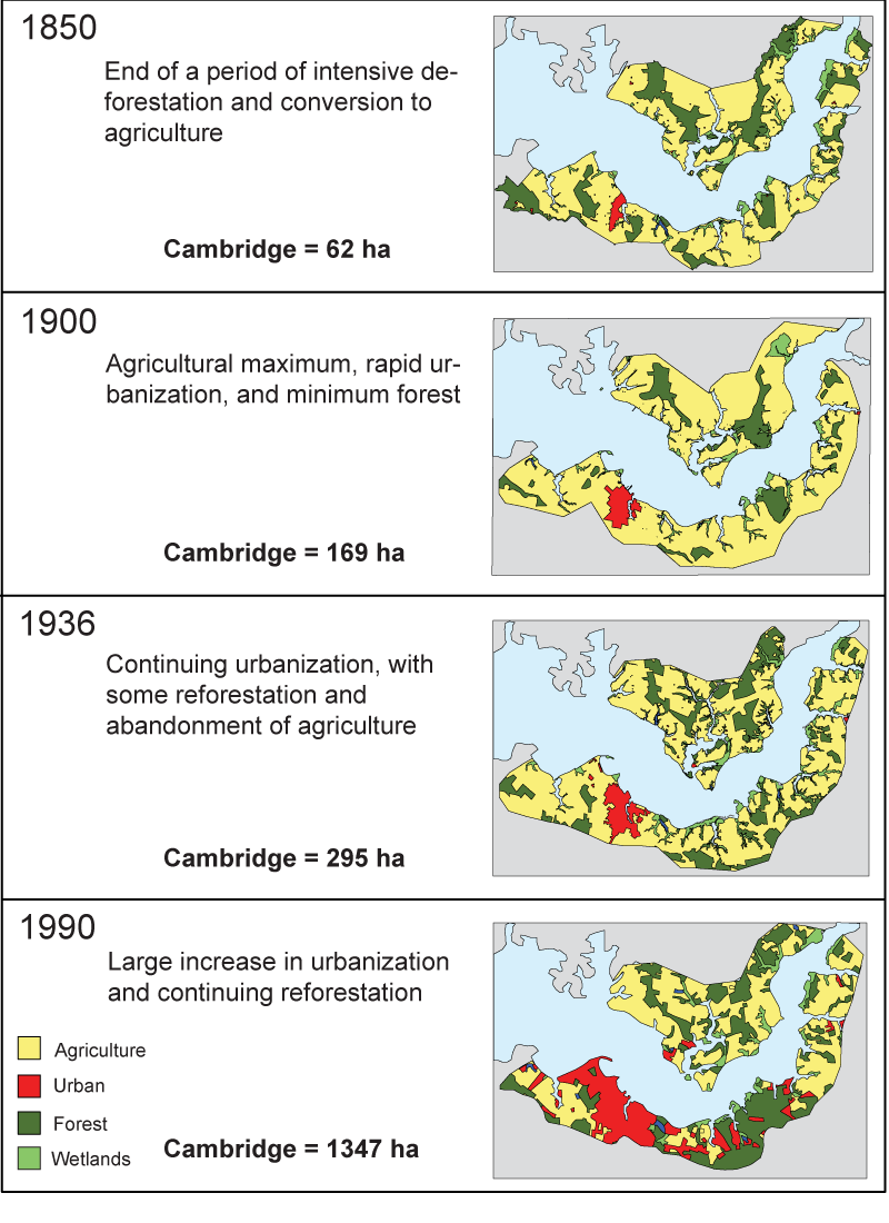
. Although agriculture has decreased somewhat since the beginning of the 20th century, it remains the most common land use in the Choptank River basin. Agricultural runoff is a major source of the high nutrient inputs that can lead to dead zones (above). Source: Tom Fisher, Horn Point Lab, UMCES.")